Sterling Section
of the Green Mountain Club
| Upcoming Events |
| ABOUT US: |
| Welcome! |
| Membership |
| Trips |
| Trail Work |
| History |
| Stories |
| OUR TRAIL: |
| Overview |
| Hiking |
| Camping |
| Map |
| Useful Stuff |
| Links |
|
"The Long Trail is an invitation - Mountain high and tree embowered - A free open and easy path that begins where Vermont begins . . . " - James P. Taylor Founder of Green Mountain Club, 1910 |
. . . more History"Thoughts on the history of the old town of Sterling while exploring through the woods for the lost White Rocks Trail" by Jim Pease. (Click here to go back to main Sterling Section history page.) This short guide attempts to look at the history, both civil and natural, of the White Rocks area of Morristown, Vermont. It also provides a description of the abandoned trail so that anyone with a sense of direction, a good pair of boots and a will to do as our pioneer ancestors did, unaided by brushed trail, blazes and directional signs, can locate and climb to the White Rocks. High on the side of one of Vermont's more majestic peaks, White Face Mountain (3715'), is an outcrop of rock from which a broad and unencumbered view may be obtained. This is northern Vermont's White Rocks and early in this century many outdoorsmen and women made the trek to this viewpoint. The first edition of the Guide to the Long Trail (1917) contains a map of the Mt. Mansfield region with a trail clearly marked descending from the summit of Whiteface Mt. to the rocks (0.8 ml, elev. 2880'). Later editions of the guidebook (1928) discontinued the trail but USGS topographic maps of Hyde Park, VT continued to include the trail (1930, 1953). The latter showed a trail not only descending to the rocks but continuing down to join the Green Mountain Club's Beaver Meadow Trail in Morristown (1.4 ml, elev. 1685'). It was in this valley in the last century that the town of Sterling existed, until, like the trail high above it, it was abandoned. The town was disincorporated and annexed to other towns by an act of the Vermont legislature in 1828 and 1855. The town of Sterling was first settled in the late seventeenth century. It was issued a charter in 1805 by Governor Isaac Tichenor and consisted of 23,040 acres of wooded mountainous terrain. Abbey Hemenway in her American Historical Gazette states that the location of the town is lat. 44 degrees 35' long. 4 degrees 12', bordered on the north by Johnson, the east by Morristown, the south by Mansfield (now also abandoned), and the west by Cambridge. It was a town containing two ranges of hills which divided it into three parts. Sawmills and school houses characterized the town, its population reaching 233 just before annexation. Only the very northwest corner of the town near what is now called "West Settlement" was farmed. In 1828 much of the land to the west of the main range of the Green Mountains in the town was annexed to the town of Cambridge. This included the well known Smugglers Notch area and Morses Mill. In 1855 the remaining land was divided into three parcels, roughly equal in size. The northern lot which included Daniel's Notch and Caper Hill went to Johnson, the central lot which included White Face Mt., White Rocks and the Beaver Meadow Valley went to Morristown, and the southern lot containing Spruce Peak, and the upper Sterling Brook Valley where the majority of the population lived went to the then existing town of Mansfield and later became a part of Stowe. No records could be found as to the time of the original construction of the White Rocks Trail but it is likely that the trail was built sometime between 1913 and 1917. The former being the year the first trail was built up the Sterling range from the Stowe side and the latter being the year it was included in the first edition of the Guide to the Long Trail. Nor could records of the builder(s) be found. The present status of the White Rocks Trail is as an abandoned trail. The summit of the Whiteface Mt. is the best location for first time attempts to find the trail. To reach the summit one can either a) follow the LT south from its crossing at Rte. 15 in Johnson, b) follow the LT north from its crossing at Rte. 108 in Smugglers Notch, c) utilyze the Beaver Meadow and Whiteface Trails from Morristown, or d) follow the Chilcoot Ski Trail (Smugglers Notch Ski Area) to the LT at Chilcoot Pass from Jeffersonville. Once you have arrived on the summit of Whiteface Mt. and carrying a compass and topographic map (USGS Hyde Park) in your daypack begin your descent from the highest point bearing approximately SE. Here along the very uppermost part of the ridge the trail is somewhate visible. Conveniently the ridge is very narrow and well defined, the forest is parklike and the travel is easy. Pass between several large boulders, do not stray off the ridge proper but follow its crest. Further below it is IMPORTANT TO REMEMBER this point although it may be very difficult to stay right on the ridge due to the bushwacking. However if you stray it is better to take to the SW side of the ridge as descent in this direction will eventually lead you into the Beaver Meadow area and trails to Morristown, the NE side contains a large area of trailless uninhabited land and difficulty could be had in finding one's way out if such an error is made. Still, clearly any brook followed down will eventually lead to a road and to town. The upper ridge is followed to a first outcrop of rock (.35ml) where good views may be obtained. Below and to the right is visible the White Rocks outcrop, the descent is steep, brushy and contains many ledges. Bear to the right as you descend, although it is not possible to keep the rocks in view, the obliterated trail appears to lead you to the left as do most of the convenient bushwack routes. Remember to stay above and to the right. You should arrive at the rocks surrounded by thick spruce scrub (.5ml). From here an excellent view is obtained. Below the rocks the trail has long since vanished, although you must bear left on the descent to leave the rocks because the rough steep slope directly below them, remember to compensate below. Travel here is in thick brush and rough going. Several large old birches have created gaps and are convenient rest spots. You will notice that the ridge which gives rise to the White Rocks above divides below into two river valleys. Again bear to the right on descent as soon as you get below the steep slopes of softwoods, preferably crossing the ridge above the valleys at their uppermost points. As you descend there should be no ridge closely to the right, if so you have strayed too far to the left (N), bear right (S) and cross the ridge. Descending notice the arrival of larger hardwoods, some of which may be the original old growth forest. Flats of hobblebush are also plentiful. You may cross a small plateau along the ridge (see topo, directly below "t" in White Rocks), a stream rises here that descends directly to Beaver Meadow Brook and is a good route to follow if the weather or darkness are onset. The original route is to the right on descending, of the stream and descends steeply. Red flags may be visible approximately every 50 yards to a brook on a flat. From here a logger's tote road leads to the right descending gradually. The road is barely distinguishable but it is there if you look. It can be followed with one turn, downhill, following intermittent red flags to the Beaver Meadow Trail (1.4 ml). Depending on the time of year of a visit to the White Rocks area a careful observer can find anything from a spring flush of Wakerobin Trillium to abundant snow tracks of the Eastern Cottontail Rabbit. Spring is the best time for flowers with Spring Beauties, Blood root, Trillium, Lady Slipper, Bluebead Lily and Canada Mayflower carpeting the boreal forest floor. Careful searching may reveal subalpine species in the rocks and crags of the ridge such as Mt. Sandwort, Bilberry and Labrador Tea. Early migratory birds include many warblers including possibly the Bay breasted warbler which appeared on the slopes of Mt. Mansfield one year in flocks to feed on an insect outbreak that threatened to defoliate the slopes. Another interesting possibility is the Mt. Bluebird now making a comeback on cleared slopes and in logging areas. The forest of these upper slopes is predominately two species Balsam Fir and Red Spruce. However several other species occur with regularity including White Birch, Mt. White Birch, Yellow Birch, Mt. Ash, Sumac and Cherry. The latter two will commonly fill gaps left in the forest as a result of windfall or ice damage. Sterling Valley, Whiteface Mt., and White Rocks are all part of the town of Morristown. The town includes within its boundaries approximately 1000 acres of State Forest land, largely the western mountainous part of the township. However a survey of old maps and the puzzling together of facts and figures shows that close to 50% of the old town of Sterling has been included within the Mt. Mansfield State Forest. In other words, close to 10,000 acres of the original charter 23,040 acres granted by Isaac Tichenor in 1805 has been set aside forever by the state for recreation, commercial forestry and hopefully pristine mountain ridges where outdoorsmen and women can experience wildness and solitude as only can be found in such places as the Green Mountains of Vermont. 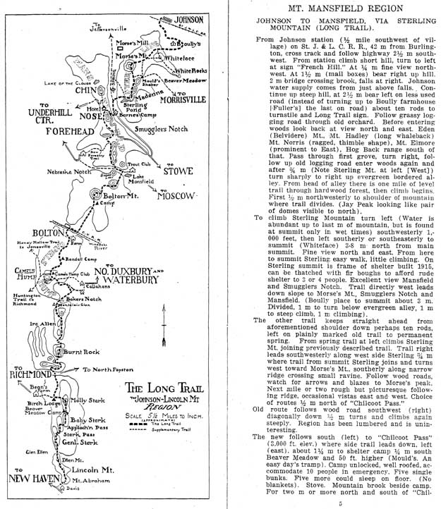 Photocopy of a page from 1917 edition of Guide to the Long Trail.
|
|||||||||
|
|||||||||
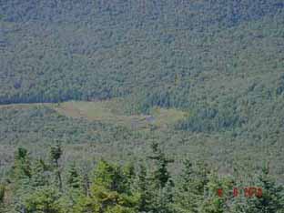 View of Beaver Meadow from above.
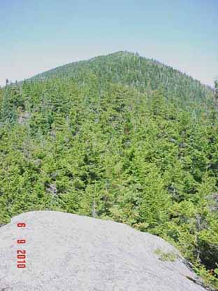 View north from Whiteface summit.
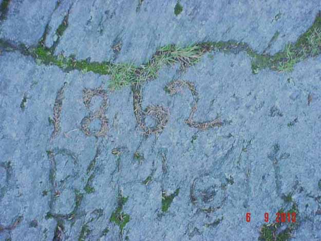 Historic carving in rock on Whiteface.
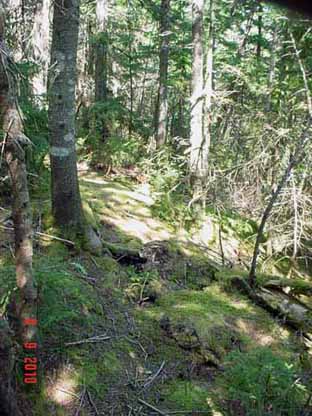 Along the old Whiteface trail.