Sterling Section
of the Green Mountain Club
| Upcoming Events |
| ABOUT US: |
| Welcome! |
| Membership |
| Trips |
| Trail Work |
| History |
| Stories |
| OUR TRAIL: |
| Overview |
| Hiking |
| Camping |
| Map |
| Useful Stuff |
| Links |
|
"The Long Trail is an invitation - Mountain high and tree embowered - A free open and easy path that begins where Vermont begins . . . " - James P. Taylor Founder of Green Mountain Club, 1910 |
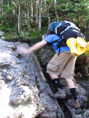
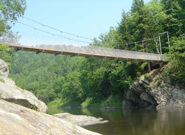
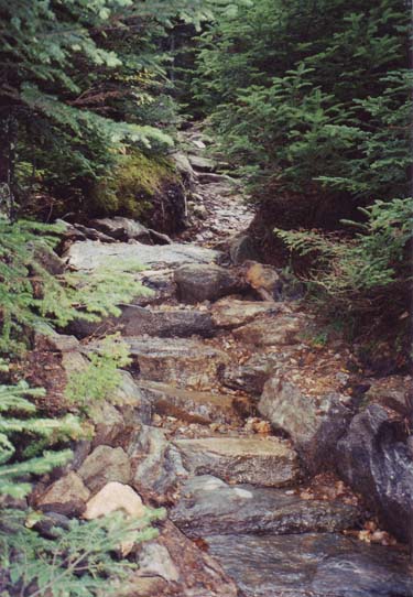
Top and Bottom: Typical trail. Middle: Long Trail bridge over the Lamoille River. (photos by Greg Western) |
Our Trail - HikingOur trails are primitive hiking trails. They are narrow, steep, rugged. They are meant to be easy to follow in the sense that the route is cleared and marked. Beyond that, the trail construction we do is intended only to make a durable tread that can carry hiker traffic without eroding, not make a physically easy path. (That said, at lower elevations the trails often follow dirt roads or in one case an old railbed, providing a variety of options for people of different abilities.) Trails are marked with 2x6 inch blazes painted on trees. White blazes indicate the Long Trail, and all other trails use blue blazes. Trail junctions have simple routed wooden signs. Just follow the blazes - you'll end up somewhere nice! The trails in our Section are:
The Section has four distinct "flavors." First is Beaver Meadow. This is a remote, backcountry bowl, surrounded on three sides by tall ridges and open only to the east. The Beaver Meadow Trail accesses this area from trailhead parking in Morristown and leads to the center of the bowl - an open area which is sometimes a meadow and sometimes a pond depending on the amount of beaver activity lately. From the center of the bowl, two trails lead steeply up to the Sterling Ridge; the Chilcoot Trail and the Whiteface Trail. Second is the Sterling Ridge itself. The Long Trail runs along the high point of the ridge, with numerous good views from Morse Mt. and Whiteface Mt. The trail here can be reached by hiking up from Beaver Meadow, or by parking farther south at the trailhead parking on Route 108 in Smugglers Notch. (Note: This high elevation forest is a fragile and protected ecosystem. Please "leave no trace" by staying on the marked trail. In addition, the ridge line is closed by the State of Vermont to recreational hiking during the spring "mud season" each year - opening officially for summer use on Memorial Day weekend. Please respect the courtesies we should all observe on this public land we all own together.) Third is the long descent from Whiteface to the Lamoille River. The trail passes through many life zones as it descends, and enters a working landscape with forestry and farming. Eventually it ends up on logging roads and then on the "West Settlement Road" (a dirt road in Johnson.) (Note: The trail crosses private land at various places along this stretch; through the long time generosity of local land owners. Please respect the private property of individuals who allow the trail to cross their land, and thank them!) Finally, the trail turns off the West Settlement Road on to the Lamoille Valley Rail Trail. This is a multi use trail created from a former railroad. Leaving the railbed, the trail crosses a hay field and reaches the trailhead parking at Route 15. North of the parking is another hay field, then a small but grand piece of forest along the banks of the Lamoille, and finally a large suspension bridge over the river. (Note: When the Lamoille River floods - every spring and after heavy rains in summer and fall - about 100 feet of the Long Trail is under water, cutting off access to the main river bridge. Please do not attempt to walk through the flooding water. The alternate highwater route is to follow public roads and cross the river on a highway bridge. Go east on Route 15 from the Long Trail parking lot, then turn left (northwest) on to Hogback Road and follow it back to the trail.) All in all, it's a pretty good trail - we look forward to seeing you out there! |